GNSS
In GNSS (Global Navigation Satellite System) positioning and timing data is encoded in the satellite signals from space. GNSS is used for example in land surveying, mapping, location based services, precision farming, space applications, maritime, machine control and mining. Accuracy, continuity and availability are essential in GNSS.
The solution:
SATEL’s radio networking technology
SATEL’s radio technology is used worldwide in a variety of GNSS RTK, remote measurement and control and interrogation applications. It provides an independent solution based on quality, reliability, continuity and low life cycle cost. The radio technology is used both separately and also as integrated into measurement devices. The installation is made easy.
In real-time Differential Global Positioning System (DGPS) and Real Time Kinematic GPS (RTK) the data is transmitted from the base GNSS receiver situated in a known position to the rover GNSS receiver. The rover GNSS receiver takes the base data into account in order to calculate its own position in centimeter accuracy. SATEL’s radio technology is an excellent choice for wireless data link between GNSS base and rover stations. SATEL radio modem sends the position correction data from the base station to the rover once a second.
Examples of GNSS systems with our products are:
- Land surveying: Correction data from the base to the rover station
- Agriculture: Precision farming
- Machine control: Based to positioning information
- Harbor logistics: Wireless container positioning information and terminal management systems
- Port cranes: Remote and real-time control based to positioning information
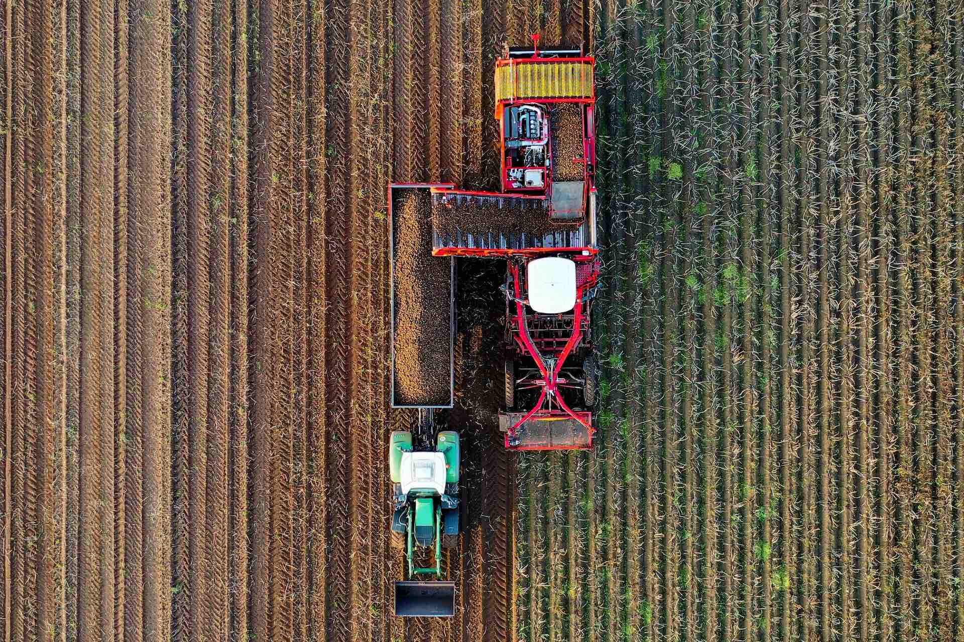
Sustainability matters in precision farming
Precision agriculture or precision farming is a modern way to use technology to monitor and optimize production processes. It uses sensor technologies, satellite navigation and positioning technology.
Precision farming increases the quantity, accuracy and quality of agriculture. Its aim is to save costs, reduce environmental impact and, of course, produce more and better food. It makes it possible to use less energy, water, fuel, pesticides and fertilizers. Precision farming helps in managing production in an environmentally sustainable way.
Technology is used to measure variations in field’s conditions and then utilize this site-specific information in matching the fertilizer, seed and chemical rates with the conditions. Fertilizers and pesticides are used only where and when they are actually needed. This technology can also be used to assess individual animal’s condition and needs in larger herds, which enables optimizing feeding on an animal basis.
- No excess applications
- Reducing the chemical load
- Reducing the development in pesticide resistance
Most common technologies used are yield mapping, soil mapping, auto-guidance machinery steering, and variable rate technologies (VRT).
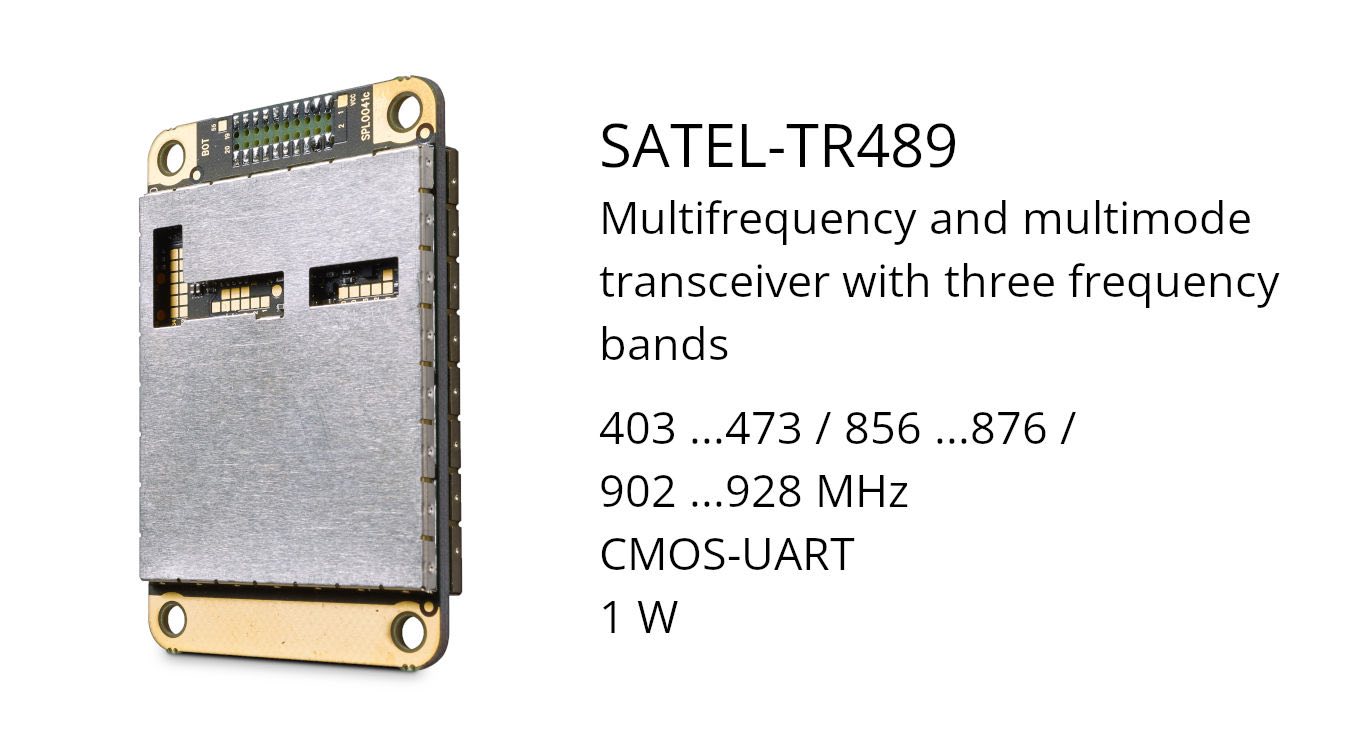
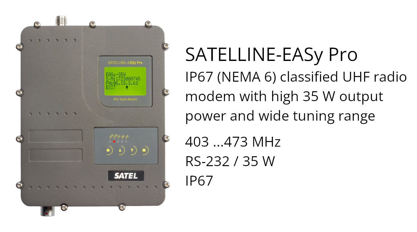
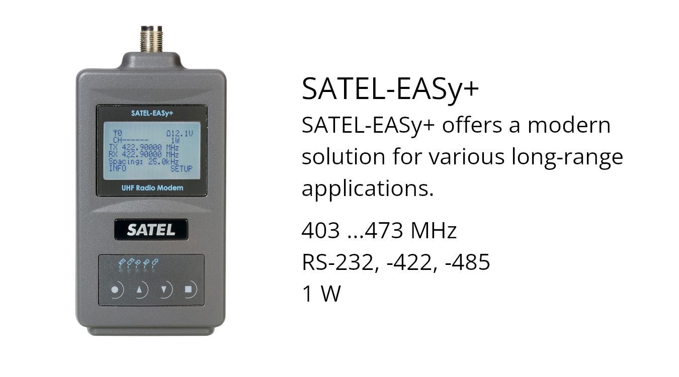
Related products


GNSS
In GNSS (Global Navigation Satellite System) positioning and timing data is encoded in the satellite signals from space. GNSS is used for example in land surveying, mapping, location based services, precision farming, space applications, maritime, machine control and mining. Accuracy, continuity and availability are essential in GNSS.
The solution:
SATEL’s radio networking technology
SATEL’s radio technology is used worldwide in a variety of GNSS RTK, remote measurement and control and interrogation applications. It provides an independent solution based on quality, reliability, continuity and low life cycle cost. The radio technology is used both separately and also as integrated into measurement devices. The installation is made easy.
In real-time Differential Global Positioning System (DGPS) and Real Time Kinematic GPS (RTK) the data is transmitted from the base GNSS receiver situated in a known position to the rover GNSS receiver. The rover GNSS receiver takes the base data into account in order to calculate its own position in centimeter accuracy. SATEL’s radio technology is an excellent choice for wireless data link between GNSS base and rover stations. SATEL radio modem sends the position correction data from the base station to the rover once a second.
Examples of GNSS systems with our products are:
- Land surveying: Correction data from the base to the rover station
- Agriculture: Precision farming
- Machine control: Based to positioning information
- Harbor logistics: Wireless container positioning information and terminal management systems
- Port cranes: Remote and real-time control based to positioning information
Sustainability matters in precision farming
Precision agriculture or precision farming is a modern way to use technology to monitor and optimize production processes. It uses sensor technologies, satellite navigation and positioning technology.
Precision farming increases the quantity, accuracy and quality of agriculture. Its aim is to save costs, reduce environmental impact and, of course, produce more and better food. It makes it possible to use less energy, water, fuel, pesticides and fertilizers. Precision farming helps in managing production in an environmentally sustainable way.
Technology is used to measure variations in field’s conditions and then utilize this site-specific information in matching the fertilizer, seed and chemical rates with the conditions. Fertilizers and pesticides are used only where and when they are actually needed. This technology can also be used to assess individual animal’s condition and needs in larger herds, which enables optimizing feeding on an animal basis.
- No excess applications
- Reducing the chemical load
- Reducing the development in pesticide resistance
Most common technologies used are yield mapping, soil mapping, auto-guidance machinery steering, and variable rate technologies (VRT).
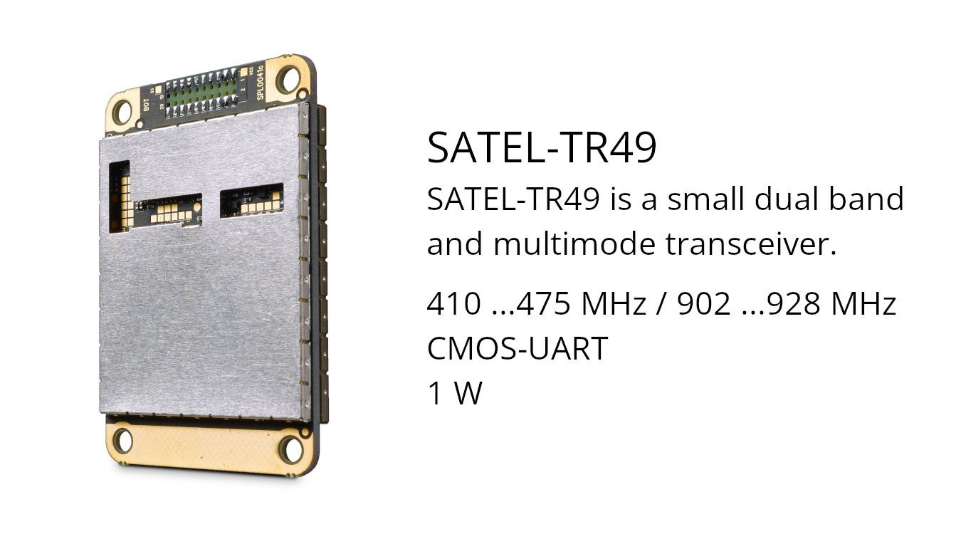
Related products